Search

Categories

    • categories-img Jacket, Women
    • categories-img Woolend Jacket
    • categories-img Western denim
    • categories-img Mini Dresss
    • categories-img Jacket, Women
    • categories-img Woolend Jacket
    • categories-img Western denim
    • categories-img Mini Dresss
    • categories-img Jacket, Women
    • categories-img Woolend Jacket
    • categories-img Western denim
    • categories-img Mini Dresss
    • categories-img Jacket, Women
    • categories-img Woolend Jacket
    • categories-img Western denim
    • categories-img Mini Dresss
    • categories-img Jacket, Women
    • categories-img Woolend Jacket
    • categories-img Western denim
    • categories-img Mini Dresss

Filter By Price

$
-
$

Dietary Needs

Top Rated Product

product-img product-img

Modern Chair

$165.00
product-img product-img

Plastic Chair

$165.00
product-img product-img

Design Rooms

$165.00

Brands

  • Wooden
  • Chair
  • Modern
  • Fabric
  • Shoulder
  • Winter
  • Accessories
  • Dress

Welcome and thank you for visiting us. For any query call us on 0799 626 359 or Email [email protected]

Offcanvas Menu Open

Shopping Cart

Africa largest book store

Sub Total:

Search for any Title

Longs Peak : Trails Illustrated National Parks - 2019th ed.

By: (Author) National Geographic Maps

Extended Catalogue

Ksh 2,150.00

Format: Sheet Map, Folded

ISBN-10: 1566954312

ISBN-13: 9781566954310

Edition: 2019th ed.

Publisher: National Geographic Maps

Imprint: National Geographic Maps

Country of Manufacture: US

Country of Publication: GB

Publication Date: Aug 2nd, 2012

Print length: 1 Pages

Weight: 66 grams

Dimensions (height x width x thickness): 19.10 x 10.20 x 0.50 cms

Product Classification: Travel maps & atlases

Choose your Location

Shipping & Delivery

Door Delivery

Delivery fee

Delivery in 10 to 14 days

  • Description

  • Reviews

National Geographic's Trails Illustrated Maps are the most detailed and up-to-date topographic recreation maps available for US National Parks, National Forests and other popular outdoor recreation areas. A necessity for exploring the outdoors, each map is printed on waterproof, tear-resistant material. They also contain key safety and contact information, GPS and compass coordinates, Leave No Trace ethical guidelines and hundreds of points-of-interest, including scenic viewpoints, campgrounds, boat launches, swimming areas, marine sanctuaries and wildlife refuges.
National Geographic''s Trails Illustrated Maps are the most detailed and up-to-date topographic recreation maps available for US National Parks, National Forests and other popular outdoor recreation areas. A necessity for exploring the outdoors, each map is printed on waterproof, tear-resistant material. They also contain key safety and contact information, GPS and compass coordinates, Leave No Trace ethical guidelines and hundreds of points-of-interest, including scenic viewpoints, campgrounds, boat launches, swimming areas, marine sanctuaries and wildlife refuges.

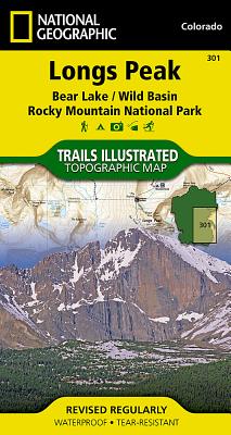
Get Longs Peak by at the best price and quality guranteed only at Werezi Africa largest book ecommerce store. The book was published by National Geographic Maps and it has pages. Enjoy Shopping Best Offers & Deals on books Online from Werezi - Receive at your doorstep - Fast Delivery - Secure mode of Payment

Customer Reviews

Based on 0 reviews

Mind, Body, & Spirit