Search

Categories

    • categories-img Jacket, Women
    • categories-img Woolend Jacket
    • categories-img Western denim
    • categories-img Mini Dresss
    • categories-img Jacket, Women
    • categories-img Woolend Jacket
    • categories-img Western denim
    • categories-img Mini Dresss
    • categories-img Jacket, Women
    • categories-img Woolend Jacket
    • categories-img Western denim
    • categories-img Mini Dresss
    • categories-img Jacket, Women
    • categories-img Woolend Jacket
    • categories-img Western denim
    • categories-img Mini Dresss
    • categories-img Jacket, Women
    • categories-img Woolend Jacket
    • categories-img Western denim
    • categories-img Mini Dresss

Filter By Price

$
-
$

Dietary Needs

Top Rated Product

product-img product-img

Modern Chair

$165.00
product-img product-img

Plastic Chair

$165.00
product-img product-img

Design Rooms

$165.00

Brands

  • Wooden
  • Chair
  • Modern
  • Fabric
  • Shoulder
  • Winter
  • Accessories
  • Dress

Welcome and thank you for visiting us. For any query call us on 0799 626 359 or Email [email protected]

Offcanvas Menu Open

Shopping Cart

Africa largest book store

Sub Total:

Search for any Title

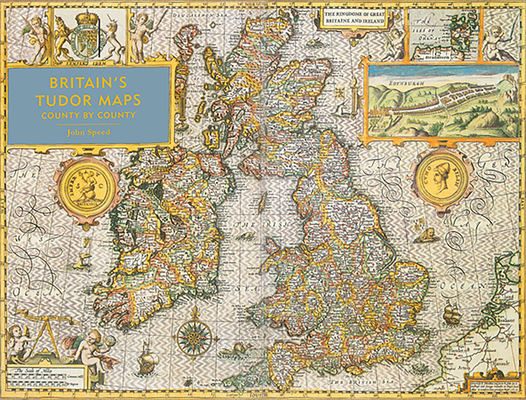
Britain's Tudor Maps : County by County

By: (Author) John Speed

Extended Catalogue

Ksh 6,550.00

Format: Hardback or Cased Book

ISBN-10: 1849943842

ISBN-13: 9781849943840

Publisher: Batsford

Imprint: Batsford

Country of Manufacture: GB

Country of Publication: GB

Publication Date: Oct 13th, 2016

Print length: 160 Pages

Weight: 1,906 grams

Dimensions (height x width x thickness): 31.50 x 40.90 x 1.80 cms

Choose your Location

Shipping & Delivery

Door Delivery

Delivery fee

Delivery in 10 to 14 days

  • Description

  • Reviews

A stunning new edition of the earliest atlas of the British Isles, Britain’s Tudor Maps: County by County reproduces the maps of John Speed’s 1611 collection The Theatre of Great Britain in large format for the first time, with towns and topographical features wonderfully clear and easy to read alongside Alasdair Hawkyard’s fascinating commentary.

A stunning new edition of the earliest atlas of the British Isles.

Britain’s Tudor Maps: County by County reproduces the maps of John Speed’s 1611 collection The Theatre of Great Britaine in large, easy-to-read format for the first time. Compiled from 1596, these richly detailed maps show each county of Great Britain individually and as they existed at the time, complete with a wealth of heraldic decoration, illustrations and royal portraits.

With an introduction by the bestselling author Nigel Nicholson, each map is presented alongside a fascinating commentary by Alasdair Hawkyard, elaborating on both the topographical features and the social conditions of each county at the time, enabling an examination of how the physical and social landscape has been transformed over time.


Get Britain's Tudor Maps by at the best price and quality guranteed only at Werezi Africa largest book ecommerce store. The book was published by Batsford and it has pages. Enjoy Shopping Best Offers & Deals on books Online from Werezi - Receive at your doorstep - Fast Delivery - Secure mode of Payment

Customer Reviews

Based on 0 reviews

Mind, Body, & Spirit