Search

Categories

    • categories-img Jacket, Women
    • categories-img Woolend Jacket
    • categories-img Western denim
    • categories-img Mini Dresss
    • categories-img Jacket, Women
    • categories-img Woolend Jacket
    • categories-img Western denim
    • categories-img Mini Dresss
    • categories-img Jacket, Women
    • categories-img Woolend Jacket
    • categories-img Western denim
    • categories-img Mini Dresss
    • categories-img Jacket, Women
    • categories-img Woolend Jacket
    • categories-img Western denim
    • categories-img Mini Dresss
    • categories-img Jacket, Women
    • categories-img Woolend Jacket
    • categories-img Western denim
    • categories-img Mini Dresss

Filter By Price

$
-
$

Dietary Needs

Top Rated Product

product-img product-img

Modern Chair

$165.00
product-img product-img

Plastic Chair

$165.00
product-img product-img

Design Rooms

$165.00

Brands

  • Wooden
  • Chair
  • Modern
  • Fabric
  • Shoulder
  • Winter
  • Accessories
  • Dress

Welcome and thank you for visiting us. For any query call us on 0799 626 359 or Email [email protected]

Offcanvas Menu Open

Shopping Cart

Africa largest book store

Sub Total:

Search for any Title

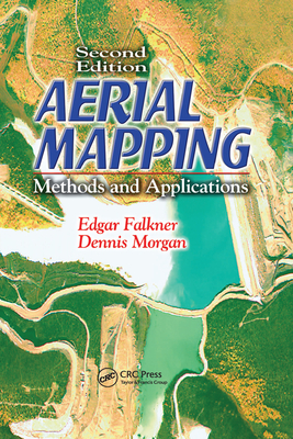
Aerial Mapping : Methods and Applications, Second Edition

By: (Author) Dennis Morgan , (Author) Edgar Falkner

Manufacture on Demand

Ksh 10,450.00

Format: Paperback / Softback

ISBN-10: 0367578727

ISBN-13: 9780367578725

Edition Number: 2

Series: Mapping Science

Publisher: Taylor & Francis Ltd

Imprint: CRC Press

Country of Manufacture: GB

Country of Publication: GB

Publication Date: Jun 30th, 2020

Print length: 216 Pages

Weight: 420 grams

Dimensions (height x width x thickness): 15.60 x 23.40 x 1.60 cms

Choose your Location

Shipping & Delivery

Door Delivery

Delivery fee

Delivery in 10 to 14 days

  • Description

  • Reviews

The juxtaposed technologies of photogrammetry, image analysis, and remote sensing have become so dynamically intertwined and progressive that an easy-to-use, up-to-date resource is sorely needed. High-speed computers, scanners, and remote sensors constantly change the way mapping is done. The second edition of a bestseller, Aerial Mapping:
Building on the foundation of the bestselling first edition, Aerial Mapping: Methods and Applications, Second Edition provides you with a practical understanding of aerial photography, remote sensing, and photogrammetric mapping. The content is deliberately semi-technical and processes are discussed in a manner easily accessible to anyone regardless of their technical or scientific background.

This new edition highlights the significant changes in equipment and techniques. High-speed computers, scanners, and remote sensors have changed the way mapping is done. The principles of photogrammetry, image analysis, and remote sensing have become dynamically intertwined. With the solid grounding in basic procedures that Aerial Mapping: Methods and Applications, Second Edition provides you can apply your knowledge to the special conditions of each aerial mapping project.

Get Aerial Mapping by at the best price and quality guranteed only at Werezi Africa largest book ecommerce store. The book was published by Taylor & Francis Ltd and it has pages. Enjoy Shopping Best Offers & Deals on books Online from Werezi - Receive at your doorstep - Fast Delivery - Secure mode of Payment

Customer Reviews

Based on 0 reviews

Mind, Body, & Spirit